
Urban Soils
Urban Soils Resources
NYC Detailed Soil Survey via Web Soil Survey
The 1:12,000 scale soil map covers 235,945 acres and has a minimum size delineation of 1.5 Acres. New York City has approximately 27 percent open space and this is where the majority of the field investigations were conducted. 70 soil series were identified in the survey; 32 of which were developed in human transported materials (HTM) and 38 in naturally occurring parent materials (glacial till, outwash, etc.). Over 100 soil profiles were sampled and analyzed for complete characterization by the USDA-NRCS Kellogg Soil Survey Laboratory. The soils of the city exhibit a wide range of physical, chemical and mineralogical properties in both the natural and anthropogenic soils.
NYC Reconnaissance Soil Survey and Map
This survey provides a general guide to soil patterns across the city and serves as the starting point for more intensive surveys across the city.
The map scale is 1:62,500, and the minimum size delineation is 40 acres. The map is composed of 88 soil map units, comprised of 20 anthropogenic and 24 natural soil series. The map projection is UTM zone 18N. PLEASE NOTE: Soil survey maps are never intended to replace an on-site assessment.
Bronx River Watershed Soil Survey and Map
The report provides the descriptions of soil map units and soils of the Bronx River Watershed, including the nature of the watershed, the infiltration study, and comprehensive soil physical and chemical property data. The map with legend is composed of 89 soil map units, comprised of 9 anthropogenic and 15 natural soil series. The maps scale is 1:6,000, and the minimum size delineation is 0.15 acres.
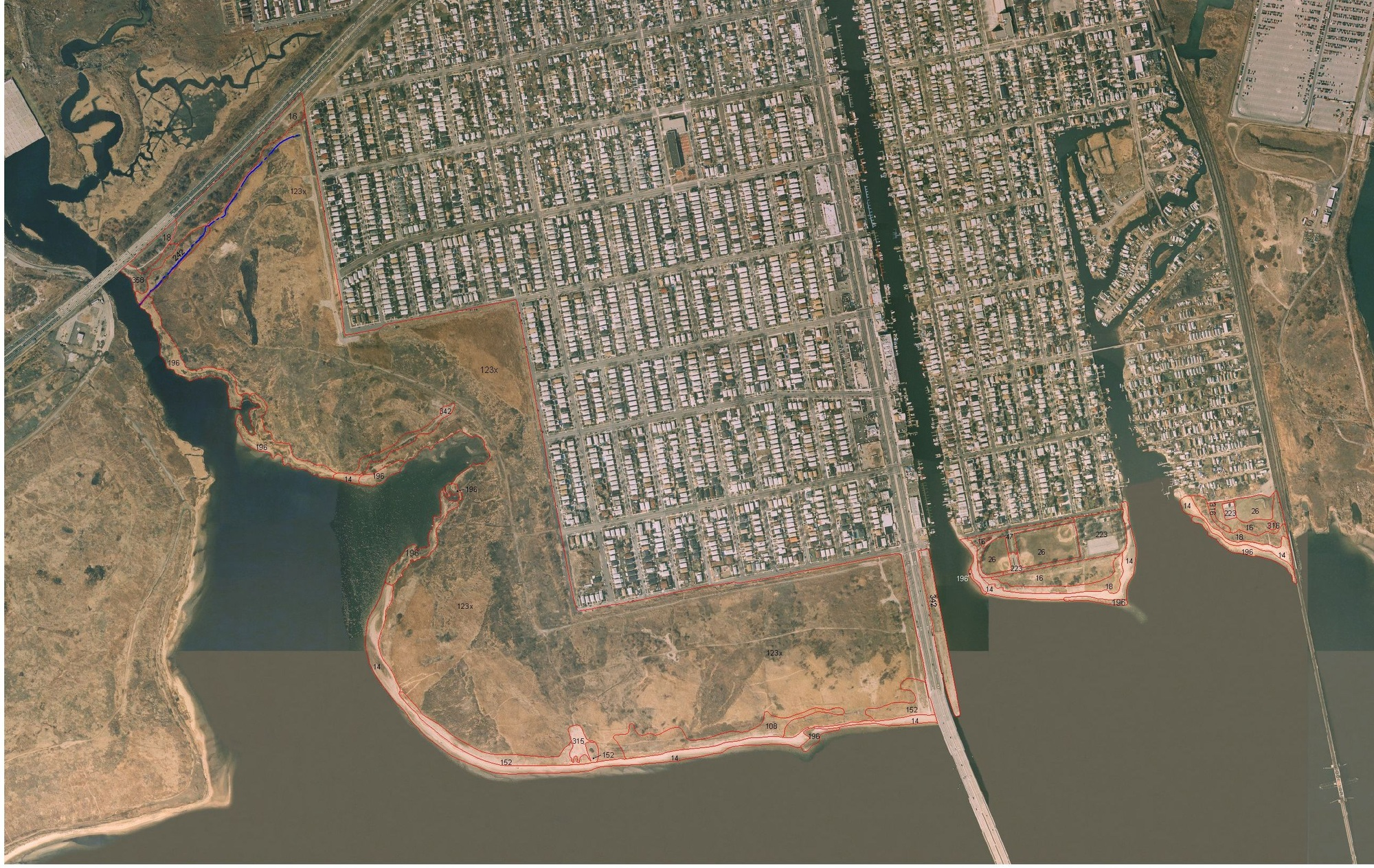
Gateway National Recreation Park Soil Survey and Map
This survey is one of the first attempts made by NRCS scientists to map and provide detailed soil series information for human modified soils. The information published in this document will provide technical guidance for future land use and management decisions. It will also serve as a valuable data element for research projects in natural resources and an important environmental education tool.
The map file is a ZIP archive containing individual soil maps (1:4,800 scale) for the survey area. Its 25,300 acres are distributed in three New York City (NYC) counties (Kings, Queens and Richmond) and one New Jersey county (Monmouth). An index for the individual maps is found on the last page of the corresponding Gateway Soil Survey Report
